


1. June - 31. October 2000

Niger

Ancient trade routes
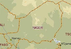
The Sahara to the north and the river Niger to the south west determine the character of this West African country. The relationships between the nomadic Tuareg, who wandered the desert, and the settled farmers along the river which gave the country its name, stand out like a red flag across the history of the country.
In the 14th century, the Tuareg-controlled kingdom of Takedda played an important role in foreign trade. One reason was the rich copper mines, as copper was a recognized currency throughout West Africa. Archaeological finds testify that at that time farming communities existed where now is only desert. The south-eastern part of the country belonged for many centuries to the kingdom of the Bornu dynasty, whose power stemmed from the control of the salt resources and of oases and trade routes which extended from Lake Chad to Libya.
The Sahara has expanded dramatically over the last 350 years. It is, however, not only periods of drought which promote the advance of the desert, but also a process of "development" begun back in the French colonial era. This includes taking over large tracts of land for the cultivation of cotton and peanuts for export, the over-grazing of the land, and the rejection of long-established traditional land-use methods such as long fallow periods and nomadic stock rearing.
In recent years, foreign income from uranium exports has been used to develop an agricultural economy based on self-sufficiency.
The poor food supply situation facing much of the population and economic problems are partially responsible for the country's political instability. Since the elections in December of last year, however, a democratically-elected president is once again in place with an effective parliament.